
Click on any picture for a larger version.
Comment: The Friendship Cruis has not occurred in recent years for various reasons. Check the official site (use Google, or one of the links at the bottom of the page) for further information.
What is the
Friendship
Cruise?
|
The Friendship Cruise had its roots in 1958 or so when a resident of the small town of Green River, Utah (a town that is on the Green River, not surprisingly) decided to take his airboat down the Green River, around the confluence of the Green and Colorado Rivers, and up to Moab, Utah - a distance of over 180 river miles. This feat caught the attention of some of the other locals who also decided to try it. It eventually snowballed into more than just a local event - it turned into a race to see who could get from Green River to Moab the fastest - via the river.
Sometime later, this fast-paced race spawned a more family-oriented event - the Friendship Cruise - which occurs on the Memorial Day weekend. The object of this event was not to race through the course, but rather to make this journey at a more leisurely pace - taking several days instead of several hours. People used their own boats - anything from a pontoon boat to the boat they use to go water skiing - as long as it had enough power to make its way against the current on the Colorado River from the confluence to Moab. Eventually, the race was discontinued, but the cruise itself remained.
If you aren't familiar with the geography of this area, it is worth pointing out that this river course cuts through the Utah desert in some of the most remote territory in the lower 48 states. These rivers have, through the ages, stayed at a (more or less) constant elevation while the surrounding landscape has risen - in some cases over 1/2 mile. Because of this, the rivers cut through some of the most spectacular gorges anywhere.
Ham Radio and the Friendship Cruise.
Note: Since I have been involved mostly with the Panorama Point operation, it is covered here. I should point out that the efforts of all others are considerable and are hereby acknowledged. If you have any questions, you can reach me via email.
Within a few years the popularity of the cruise overtook that of the race. At its peak, 700 or so boats would flock down/up the rivers over the course of a few days. Eventually the race was discontinued, leaving only the cruise itself.
 |
At this point it may have occurred to you that there are certain logistical concerns associated with the Friendship cruise: Keeping track of 700 boats, rescuing those that had broken down, providing fuel, and moving boat trailers from the beginning point to the end point of the cruise (or to one of the few places in between where a boat can be pulled out) requires that a lot of people keep track of a lot of others - and all of this needed to be done over a large geographical area in some of the most inhospitable territory (to humans and RF) in the country.
At first, the obvious choice seemed to be radio equipment that was already available to the public: CB. It was soon discovered that CB was capable of reaching only a few miles up and down the river - or across the country when the band was open. In other words it wasn't very useful except for extremely short range communications.
Later, higher-powered public service radios were tried. This was somewhat better than CB, but coverage within the canyons (that is, most of the course) was extremely limited. Somehow, someone involved with the Friendship Cruise got the idea of contacting amateur radio operators and since about 1965 hams have played a key role in keeping those in charge in touch with everyone else across the course. Even today, with the proliferation of cell phones, Amateur radio is still the only practical means of communications: For some reason, no-one has put dozens of cell sites up and down the river gorge on remote desert National Park land...
For very short range (such as between personnel at boat docks) 2 meters was frequently used. But how does one communicate over a reasonably large geographical area out of very deep canyons? On 75 meter SSB, of course.
Since the boats are active mostly during daylight hours, it would make sense to use 75 meters during this time: The band is useful for very short range communications and because it is used during daylight hours, QRM from other parts of the country isn't a problem. The very high angle of incidence from the ionosphere (i.e. straight up and straight down) was about the only mode possible from some of the very deep canyons - but during the day 75 meters operates in precisely this mode.
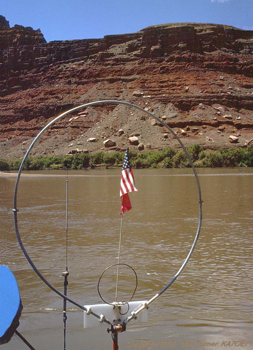
The biggest problem? It is somewhat awkward to use: 100 watt radios are needed and small, efficient "mobile" antennas for use on 75 meters are rare. Fortunately, the boats on which HF is used are metal and there is plenty of water around to act as a ground plane. Despite the near "ideal" conditions for using the mobile antennas, the antennas are still inefficient, HF is pretty noisy, and signals are pretty weak. Usually, though, someone on frequency is likely to be able to hear you well enough to relay your information to its destination.
Using 2 meters:
For the first 32 years or so that Amateur Radio has been involved 2
meters has had only a minor involvement in the Friendship cruise:
Using 2 meters, hams had no better luck than the Public Safety people
did
on their frequencies - range was extremely limited and coverage over
the
course as a whole was not possible and thus its use was relegated to
"local"
communications amongst volunteers. What about existing 2 meter
repeaters?
While there are a number of 2 meter systems in the general area that
can
cover large portions of the state, none of them provide any more than
sparse,
spotty coverage in the narrow, 1/4 to 1/2 mile deep canyons.
 |
Using 75 meters has become more convenient in recent years: Modern HF rigs are smaller and consume much less current than did the original vacuum-tube rigs - and they work better, too. Installing an HF station aboard the boat is still quite a hassle, and the constant noise from HF tends to be an annoyance over the several days spent on a river, and owing to generally weak signals and constantly changing conditions, the efficacy of a squelch to reduce this annoyance is dubious.
Starting in the early-to-middle 90's, some of the operators placed their HF stations in locations where they might be able to provide better coverage of the river(s) on 2 meters. A few of these locations (i.e. near Dead Horse Point, Upheaval Dome, and Spring Canyon point) seemed to provide reasonable coverage over parts of the river(s) - but none of them were able to cover more than fairly limited stretches.
So, in 1995, 1996 and 1997 we spent a few weekends scouting for locations that could cover large portions of the river. Previous experimentation had revealed that it may be possible to find a number of sites that, when linked together in a repeater system, could provide reasonable coverage of the entire course.
The course of the Colorado river between Moab and the confluence is somewhat straighter and the distance is more manageable than that of the Green river between the confluence and Green River (the town.) By placing the repeater site for covering this area outside the river system (instead of between the two rivers) at a point called Canyonlands Overlook we were able to get a better vantage point and eliminate many of the "dead spots" in coverage.
Covering the twisting, contorted Green River was more of a challenge: Most of the distance traveled by the boats is on the Green river and a large portion of its course places it in narrow, extremely deep canyons. Furthermore, it is surrounded by territory that is far more remote than that around the Colorado river and much less of it is accessible by vehicle. Finding a place that had both accessibility and a good vantage point proved to be quite a challenge.
One of the few practical choices was a location called Panorama Point. This location is near the western border of a portion of Canyonlands National Park (but not actually in the park) and at a high altitude (a bit over 6000 feet) located at the northern end of an isthmus, reasonably close to the southern end of the Green River. Another characteristic of this location is that it places the general course of the Green River in more-or-less a straight line toward Green River - a fairly important point, as it turns out.
A significant disadvantage (and advantage, actually...) of this location is that it is extremely remote. Driving for many hours over dirt roads - some of them very rugged 4WD jeep roads - is required to access the site. Furthermore, there is no water, shelter, or electricity at the location. Another factor that can complicate matters is that just camping at this location requires a permit while setting up a radio system on this site, even temporarily, requires a special permit. Fortunately, this "special use permit" was taken care of by the organizers of the Friendship Cruise.
Weak signals from
the
canyons:
 |
For a more-detailed technical description of the radio system,
see the Friendship
Cruise Panorama Point Technical Details page.
Even though full-sized antennas and 50 watt mobile radios are used on the boats, the signals emanating from the deep, distant canyons are extremely weak and very often subject to multipath distortion. Because of this, extreme measures must be taken in order to receive them. These facts dictate the following system requirements:
 |
To maximize system performance, we chose to do all of these.
The second point - transmit power - is a bit of a challenge:
The last point - a linked repeater system - is actually quite simple:
Minimizing impact:
Despite is extreme remoteness, Panorama Point is visited by people who decide to make the trek from the main dirt road. Some of these people drive, a few hike, but many bike in. Also, desert, unlike areas with more vigorous plant growth (and rain) does not "clean itself": Even footprints can remain visible for years.
Because others visit this location while we have the repeater system set up, we make an effort to minimize the visual effect of our station to those who may not find the sight of antennas in the air to be beautiful: We place the equipment either out of sight (you actually have to go out of your way to even find the receive site) or away from the area with the view - as in the case of the transmit site - which is placed well back from the cliff edge.
We also take pains to avoid disturbing the flora and fauna indigenous to the area - something that often proves to be an "inconvenience" - to us anyway - and we do this by confining our travel to established trails and bare rock as much as possible. Finally, because of the complete lack of "facilities" we also take out our waste. All of it! (Yes - even "that.")
How well does the repeater system work?
Overall, the Panorama Point repeater works extremely well. As it turns out, it can hear signals from practically anywhere in the southeastern portion of the state of Utah and parts of southwestern Colorado - in addition to the boats on the river. Using all of the techniques mentioned (GaAsFET mast-mounted preamps, voting receivers, gain antennas) as well as the complete lack of manmade noise, it's interesting to note that the weakest signals sound "different" from what one hears on a typical system: These signals - being solely at the mercy of thermal noise - have a slightly different "noise signature" to them that is difficult to describe.
It does have one weakness: It's an "elephant" - big ears and small mouth. That's to say that it doesn't have enough transmit power. Despite the 300 watts of RF transmitter power and 2000+ watts of effective radiated power, the biggest problem users have is that of hearing the repeater. It would seem that getting more radiated power than this would be quite a feat: One could go up to a full 1500 watts (full-legal power and a 7 dB increase) but this would involve getting an amplifier that could do this and then running a generator full time (during the day at least) just to power it.
Increasing antenna gain isn't as easy a solution as one might think: A higher gain antenna would imply a narrower beam pattern - and this could actually sacrifice coverage as the narrower beam may result in lower power off to the sides of the beam where other users may be. In other words: The solution isn't a simple one. This problem may be mitigated by manually pointing the antenna toward the area of interest, of course.
For more information on how well the various sites cover the river, go to the Repeater Coverage page.
What about cell and satellite phones?
More recently, other means of communications have become available to the general public, namely cell phones and, by extension, satellite phones. How well to these work?
The answers may or may not surprise you: Not well at all - depending on where you are.
Near the beginning or end of each course, the nearness to population centers (and therefore cell sites) makes it more likely that one can find a "hot spot" for making a call. The deeper you get into the gorges, however, it becomes increasingly unlikely that you'll find a signal at all: People who have had to resort to cell phones have reported that they'd gone ashore and climbed up to get any sort of (spotty) coverage.
With a satellite phone you have a better chance, but coverage is
also
restricted in some areas owing to the blockage of most of the sky by
the
surrounding cliffs - but then again, few people have satellite
phones...
 |
Why do this?
When one considers that just two repeaters can be set up temporarily to cover an area that is larger than that of some of the eastern U.S. states, it is amazing that this is done at all - let alone on a volunteer basis. The amateurs involved spend considerable time, effort, and money to do this task. When one considers that these remote sites are accessible only with difficulty and that all equipment, food, water, and shelter has to be hauled in and out over bad roads, one has to wonder about the fine line between dedication and sanity.
This sort of service has been called "paying the rent" - that is, the "basis and purpose of amateur radio" as spelled out in FCC part 97 (i.e. the part of the FCC rules that justifies the very existence of amateur radio) mentions that amateur radio exists for three main reasons: One of these is to provide a pool of operators trained in technical and procedural communications techniques. Another reason is to advance the state-of-the-art - that is, to come up with new techniques and technology to further the technology of communications. Finally, one of the most important reasons amateur radio exists is to provide service to the public - especially in times of disaster. The Friendship Cruise certainly fits well with the latter point, providing a service to the public as well as providing training and experience should such skills be needed in an emergency.
Note: Due to the extremely low water levels in the Green and Colorado rivers, the Friendship Cruise did not occur in 2002, 2003 or 2004. Cancellation due to low water tends to occur every 10-15 years and is thus not unprecedented. What may be unprecedented, however, is the cancellation of the cruise for three consecutive years due to low water.
The water conditions for 2005 and 2006 were favorable and the cruise was held as usual, but canceled again for 2007.
As of 2015 the Frienship Cruise had not been held for several years for various reasons. Please see the official site for more information.
Related pages are:
If you have any questions about this event, or about any of the equipment or techniques used, you may contact Clint, KA7OEI via email.
This page was last modified on 20150413. Text and images are copyright 2001-2015 by Clint Turner and all rights are reserved.
